This article was featured in the 2022 Winter Newsletter by Mitch O’Neil– iMapInvasives End User Support Specialist.
Join the iMapInvasives Hemlock Woolly Adelgid Winter Mapping Challenge!
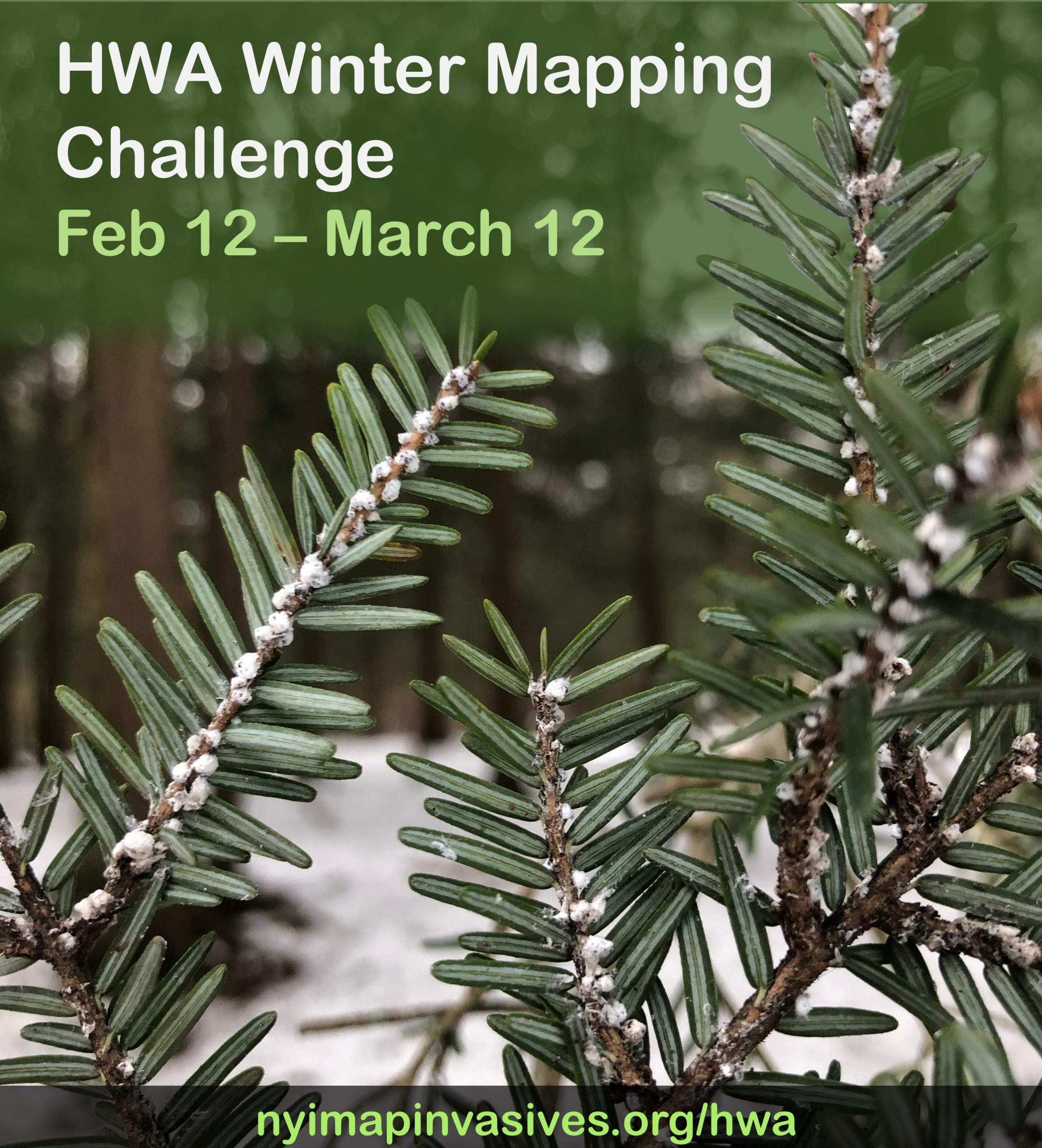
Did you know that winter is the best time to check for Hemlock Woolly Adelgid (HWA)? This tiny insect is a big problem for our forests and water resources in the Northeast (see the NYS Hemlock Initiative for more info).
How Can You Help?
From Feb 12 – March 12, NY iMapInvasives and the NYS Hemlock Initiative are hosting NY’s first statewide Winter Mapping Challenge. Join the challenge to help monitor this invasive species and compete to win a prize!
To participate:
Get outside, find some hemlock trees, check for white “fuzz balls” on the undersides of twigs, and report your findings to NY iMapInvasives – the top-reporters of presence and not-detected records for HWA will win a prize! Visit www.nyimapinvasives.org/hwa to learn more and connect with HWA mapping efforts in your area!
If you live in the St. Lawrence Eastern Lake Ontario region, check out the #VirtualHikeChallenge and learn of local hiking trails that have hemlocks near the path where you can easily survey for HWA.
Why report to iMapInvasives?
iMapInvasives is the official invasives species database for New York State. One of the most powerful components of iMap is the broad spectrum of users – iMap is used by conservation
professionals (like PRISM and Agency staff), volunteer community scientists, the general public, and everyone in between.
When you submit a record, it becomes visible to professionals in your area and across the state, who rely on accurate distribution data for their work.
Picture this – you’re out hiking on your favorite trail, and you notice strange white fuzz balls on some hemlock twigs. You open your iMapInvasives mobile app, record an observation with a clear photo, and upload it to iMapInvasives. That day, email alerts go out to SLELO PRISM staff and other professionals across the state that allows a response to be planned to help protect the forest in which you’ve reported your observation.
Outside of reporting observations, iMap data is also used in several analyses, like the Species Tiers analysis, which categorizes species based on their distributions and helps guide management priorities and goals.

